


AlpineQuest Explorer Lite

 |
Latest Version | 2.3.8d |
 |
Update | Jan,05/2025 |
 |
Developer | Psyberia |
 |
OS | Android 2.1+ |
 |
Category | Travel & Local |
 |
Size | 8.0 MB |
 |
Google PlayStore |  |
| Tags: | Travel & Local |
-
Latest Version
2.3.8d
-
Update
Jan,05/2025
-
Developer
Psyberia
-
OS
Android 2.1+
-
Category
Travel & Local
-
Size
8.0 MB
-
Google PlayStore


 Download(2.3.8d)
Turn your phone into a powerful offline GPS navigator with AlpineQuest! Using offline topographic maps, it's the ideal tool for all outdoor adventures.
No ads, data sharing, or third-party trackers.
AlpineQuest is a comprehensive solution for hiking, running, trailing, hunting, sailing, geocaching, off-road navigation, and more. Access and store a vast array of online topographic maps for offline use, even without cell service. It also supports numerous onboard raster map formats.
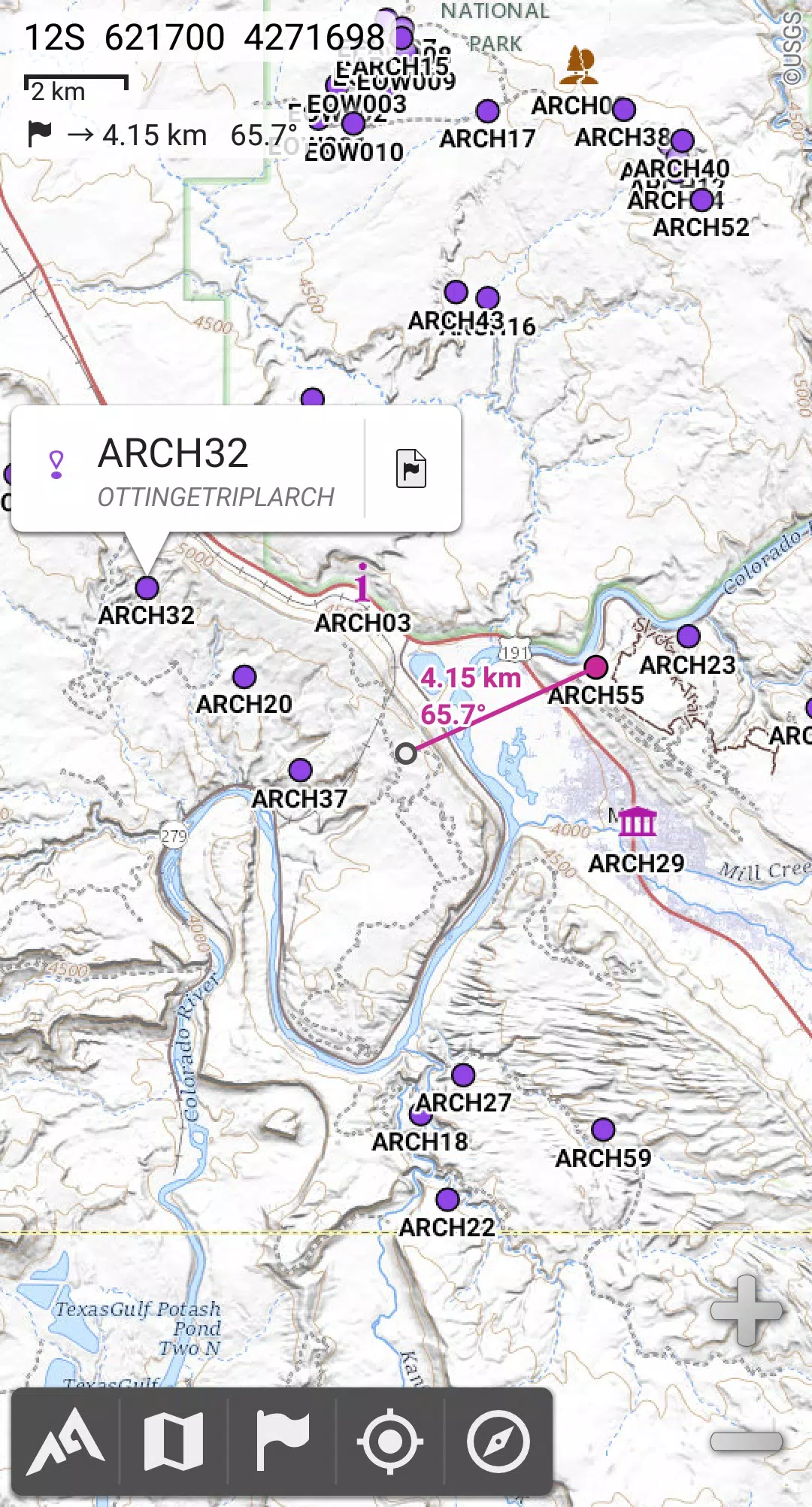
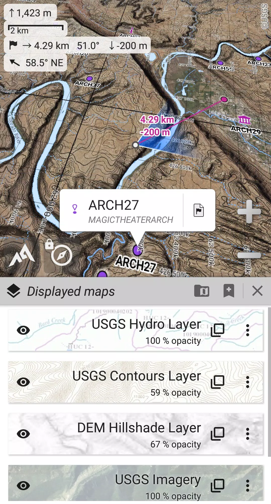
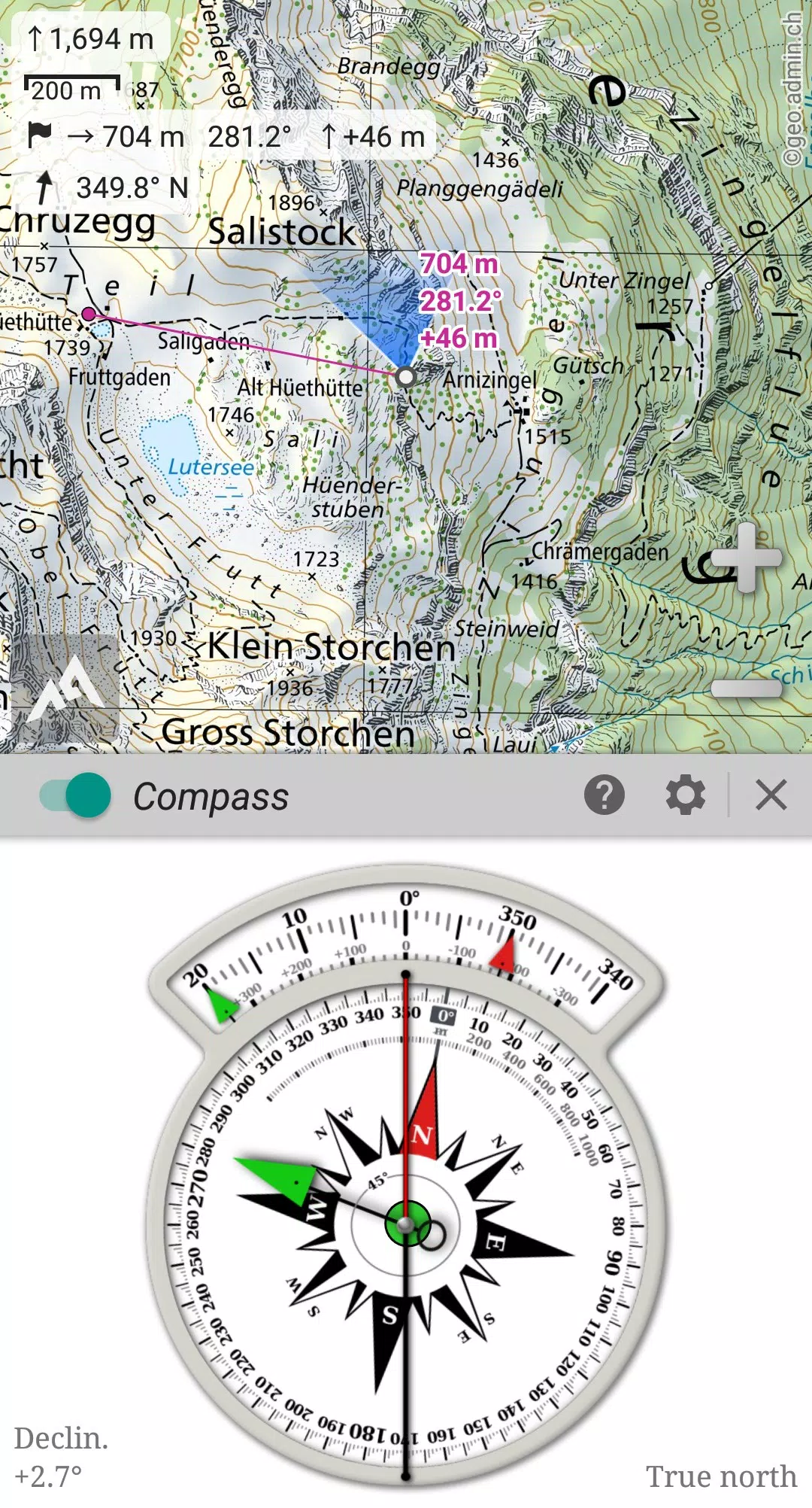
Stay oriented with real-time GPS and compass functionality. Your location is displayed on the map, which can be rotated to match your view.
Manage unlimited placemarks, share them easily, track your routes, and analyze your trips with advanced statistics and interactive charts.
Perfect for exploring remote areas, AlpineQuest ensures you stay on course, even without cell coverage.
Download the free Lite version today!
For suggestions or issues, please use our forum: https://www.alpinequest.net/forum (no registration required).
Key Features (Full Version):
Maps:
- Integrated online maps (with automatic local storage; road, topo, and satellite maps included) and online layers (road names, hillshade, contours).
- Easily add more maps and layers from the community map list.
- Complete offline area storage of online maps.
- Offline map support (raster) including KMZ Overlays, OziExplorer OZFx2, OZFx3 (partially), calibrated images, GeoTiff, GeoPackage GeoPkg, MbTile, SqliteDB, and TMS zipped tiles (use MOBAC, a free map creator, for compatibility).
- QuickChart Memory Map support (.qct maps only).
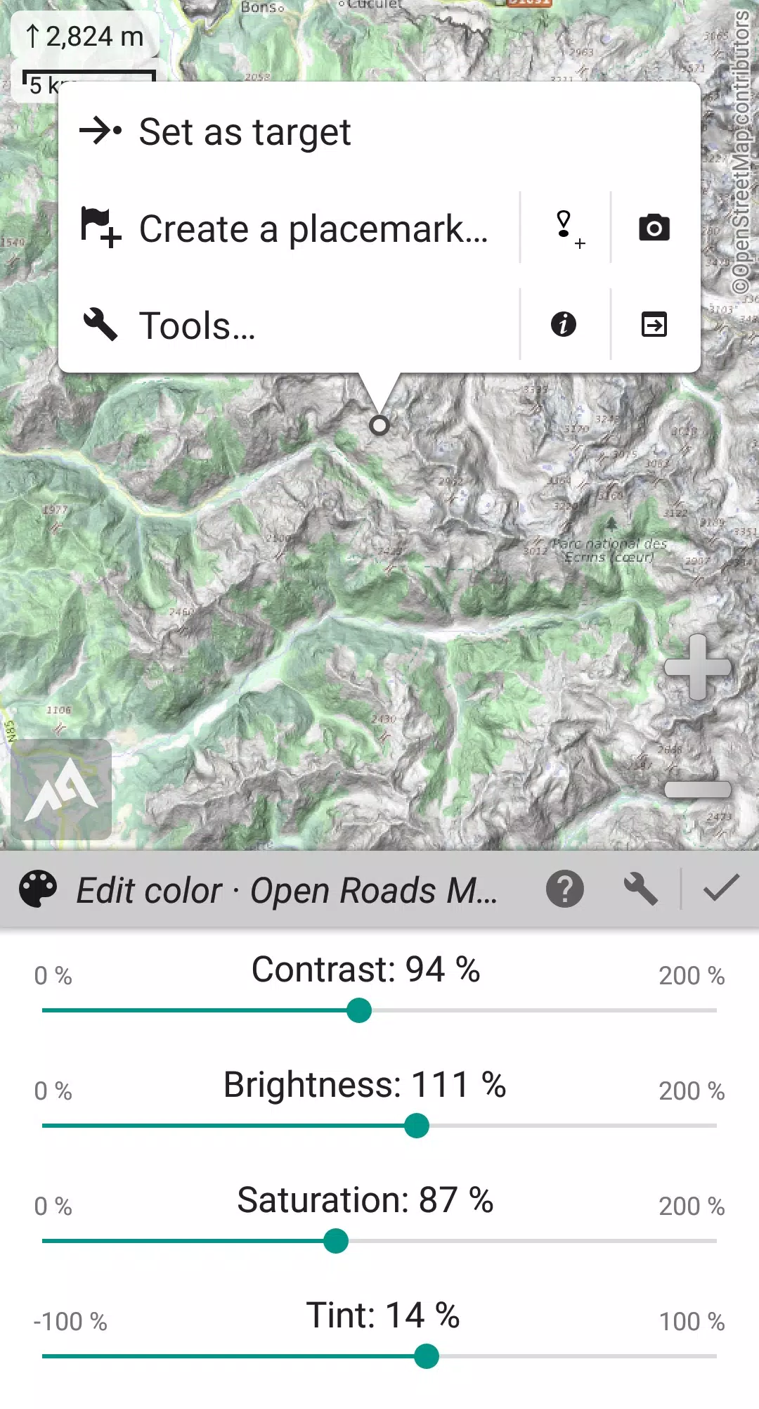
- Built-in image calibration tool.
- Digital elevation model (DEM) storage (SRTM) and HGT support for terrain, hillshade, and slope displays.
- Polar map support.
- Multi-layer map display with customizable opacity, contrast, color, tint, and blending.
Placemarks:
- Create, save, and manage unlimited waypoints, routes, areas, and tracks.
- Import/export GPX, KML/KMZ, and CSV/TSV files.
- Import ShapeFile (SHP/PRJ/DBF), OziExplorer WPT/PLT, GeoJSON, IGC tracks, and Geocaching LOC files; export AutoCAD DXF files.
- Share locations online via Community Placemarks.
- Detailed information, advanced statistics, and interactive graphics for all items.
- Time Controller for replaying time-tagged tracks.
GNSS & Orientation:
- On-map geolocation using device GNSS (GPS/GLONASS/Galileo/…) or network.
- Map orientation, compass, and target finder.
- Built-in GNSS/Barometric track recorder (long tracking, separate light process) with battery and network strength recording.
- Proximity and off-path alerts.
- Barometer support (compatible devices).
More:
- Metric, imperial, nautical, and hybrid units.
- Latitude/Longitude and various grid coordinate formats (WGS, UTM, MGRS, USNG, OSGB, SK42, Lambert, QTH, …) with on-map grid display.
- Import hundreds of coordinate formats from https://www.spatialreference.org.
What's New in Version 2.3.8d (Aug 14, 2024)
- Customizable menu bar style and position.
- Improved Android compatibility.
- Enhanced backup and restore tool.
- New default URL for sharing coordinates.
- Customizable "Media" folder for placemarks, icons, pictures, and maps.
- Added Croatian and Persian translations.
- Bug fixes and improvements.